Puebla de Farnals (Spain)

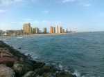
La Pobla de Farnals is a seaside resort situated around a modern marina which splits the beach in two. Both beaches are sandy and have full facilities. The beach to the north is the longer and it has lifeguards and plenty of refreshment places. The south beach is broken up by breakwaters and is ideal for children. Both have access for those with reduced mobility. There are opportunities for sailing and windsurfing.

Villar del Arzobispo (Spain)

Map

Population: 3,732 at 588 metres.
Economy: Mining, transport, services, food and agriculture sector.
Commerce: This is a small village with a few shops and bars
To Visit: Castellar hill overlooking the village with two routes to offer
Events: The Carnival & The August Festivals
Airport: Valencia Manises Airport is about three quarters of an hour away

Villar del ArzobispoIs a municipality in the interior of the Region of Valencia and belongs to the La Serranía region.The municipality is situated at an altitude of 520 metres above sea level on the left basin of the river Turia and in the extreme north of a rolling plain, on the border of a calcareous stratum, with a landscape that alters between hills and plains.In the village one can stroll through its most typical quarter, filled with streets and houses that still conserve their charm. This is a village that is situated at the head of a region in so far as number of inhabitants and services obtaining. The economy is based principally on the mining industry and transport, services and the food and agriculture sector. The landscape consists of high hills and a large plain in the lower part of the municipality. Crowning the village is the hill known by the name of Castellar, rising to 690 metres above sea level and from where one is offered a fantastic panoramic view all the way to the sea.

Villar also has two routes, „La Huella del Hombre” (The Footprint of Man) and „Ruta Monumental” (Monumental Route), which allow the visitor to get to know our past closer up, at the same time as you wander through these interior lands.

August Festivals

In honour of the Virgen de la Asunción and of San Roque (patron saint of the village). A foot race is held in the Circuit of the Provincial Council, and there is also street dancing, concerts, exhibitions and a variety of different performances.

The Carnival

The most relevant festival of Villar is the Carnival. This takes place during the weekend before Lent.

On the night of the Friday there is a street musicians competition (Murgas), satirical and amusing criticism of things that happened during the year. Saturday is the most important day, when a colourful costume parade is held in the afternoon, the burning of the „Chinchoso„.  The Chinchosa (the doll) burned at the Carnival represents the most HATED person of the last year (Franco, George W. Bush & Lewis Hamilton are examples).

The same night there is the funeral of the „Morca” preceded by a procession of torches. Bands play all weekend long. Official web: www.carnavalesdevillar.com

Casa de los Cinteros

Villar has a museum of ethnography, the Casa de los Cinteros. This is a building of certain prestige which dates back to the c.XIX and still conserves the constructive elements of the era as well as the typical buildings (stables, workroom, cellar, kitchen, rooms and entrance), all of which still contain tools of the era.

Access

50 Km. from Valencia, via the CV-35 (Valencia-Ademuz) It takes at the most, about three quarters of an hour to get to the Valencia Manises Airport.

50 km. from Requena, via the CV-395 (Requena-Segorbe).

One can also reach the village by coach (La Hispano Chelvana S.A.: Telephone numbers: 96 198 50 09 / 96 198 83 58)

Această prezentare necesită JavaScript.


Losa del Obispo (Spain)

Losa del Obispo (ValencianLa Llosa del Bisbe) is a municipality in the comarca of Los Serranos in the Valencian CommunitySpain.

Source: Wikipedia

Această prezentare necesită JavaScript.

Loriguilla (Spain)

Click on the map for bigger size

El embalse de Loriguilla, se encuentra situado en el municipio de Loriguilla, en la provincia de ValenciaComunidad ValencianaEspaña.

Se construyó en el año 1967 en el cauce del río Turia sobre una superficie de 364 ha y con una capacidad máxima de 71 hm³. Su construcción obligó a derruir las localidades de LoriguillaDomeño.

Este embalse pertenece a la Confederación Hidrográfica del Júcar.

Source: Wikipedia

Chulilla (Spain)

Chulilla (ValencianXulilla) is a municipality in the comarca of Los Serranos in the Valencian CommunitySpain.

Distancia a la capital de provincia: 59 Km.

Altitud: 400 msnm.

Superificie: 62,8 Km2

Población: En 1995, 734 habitantes.

Vegetación: Pinares (carrasco) y monte bajo mediterráneo.