Puebla de Farnals (Spain)

La Pobla de Farnals is a seaside resort situated around a modern marina which splits the beach in two. Both beaches are sandy and have full facilities. The beach to the north is the longer and it has lifeguards and plenty of refreshment places. The south beach is broken up by breakwaters and is ideal for children. Both have access for those with reduced mobility. There are opportunities for sailing and windsurfing.

Villar del Arzobispo (Spain)

Map

Population: 3,732 at 588 metres.
Economy: Mining, transport, services, food and agriculture sector.
Commerce: This is a small village with a few shops and bars
To Visit: Castellar hill overlooking the village with two routes to offer
Events: The Carnival & The August Festivals
Airport: Valencia Manises Airport is about three quarters of an hour away

Villar del ArzobispoIs a municipality in the interior of the Region of Valencia and belongs to the La Serranía region.The municipality is situated at an altitude of 520 metres above sea level on the left basin of the river Turia and in the extreme north of a rolling plain, on the border of a calcareous stratum, with a landscape that alters between hills and plains.In the village one can stroll through its most typical quarter, filled with streets and houses that still conserve their charm. This is a village that is situated at the head of a region in so far as number of inhabitants and services obtaining. The economy is based principally on the mining industry and transport, services and the food and agriculture sector. The landscape consists of high hills and a large plain in the lower part of the municipality. Crowning the village is the hill known by the name of Castellar, rising to 690 metres above sea level and from where one is offered a fantastic panoramic view all the way to the sea.

Villar also has two routes, „La Huella del Hombre” (The Footprint of Man) and „Ruta Monumental” (Monumental Route), which allow the visitor to get to know our past closer up, at the same time as you wander through these interior lands.

August Festivals

In honour of the Virgen de la Asunción and of San Roque (patron saint of the village). A foot race is held in the Circuit of the Provincial Council, and there is also street dancing, concerts, exhibitions and a variety of different performances.

The Carnival

The most relevant festival of Villar is the Carnival. This takes place during the weekend before Lent.

On the night of the Friday there is a street musicians competition (Murgas), satirical and amusing criticism of things that happened during the year. Saturday is the most important day, when a colourful costume parade is held in the afternoon, the burning of the „Chinchoso„.  The Chinchosa (the doll) burned at the Carnival represents the most HATED person of the last year (Franco, George W. Bush & Lewis Hamilton are examples).

The same night there is the funeral of the „Morca” preceded by a procession of torches. Bands play all weekend long. Official web: www.carnavalesdevillar.com

Casa de los Cinteros

Villar has a museum of ethnography, the Casa de los Cinteros. This is a building of certain prestige which dates back to the c.XIX and still conserves the constructive elements of the era as well as the typical buildings (stables, workroom, cellar, kitchen, rooms and entrance), all of which still contain tools of the era.

Access

50 Km. from Valencia, via the CV-35 (Valencia-Ademuz) It takes at the most, about three quarters of an hour to get to the Valencia Manises Airport.

50 km. from Requena, via the CV-395 (Requena-Segorbe).

One can also reach the village by coach (La Hispano Chelvana S.A.: Telephone numbers: 96 198 50 09 / 96 198 83 58)

Această prezentare necesită JavaScript.


Losa del Obispo (Spain)

Losa del Obispo (ValencianLa Llosa del Bisbe) is a municipality in the comarca of Los Serranos in the Valencian CommunitySpain.

Source: Wikipedia

Această prezentare necesită JavaScript.

Loriguilla (Spain)

Click on the map for bigger size

El embalse de Loriguilla, se encuentra situado en el municipio de Loriguilla, en la provincia de ValenciaComunidad ValencianaEspaña.

Se construyó en el año 1967 en el cauce del río Turia sobre una superficie de 364 ha y con una capacidad máxima de 71 hm³. Su construcción obligó a derruir las localidades de LoriguillaDomeño.

Este embalse pertenece a la Confederación Hidrográfica del Júcar.

Source: Wikipedia

Chulilla (Spain)

Chulilla (ValencianXulilla) is a municipality in the comarca of Los Serranos in the Valencian CommunitySpain.

Distancia a la capital de provincia: 59 Km.

Altitud: 400 msnm.

Superificie: 62,8 Km2

Población: En 1995, 734 habitantes.

Vegetación: Pinares (carrasco) y monte bajo mediterráneo.

Soroca (Moldova)

For bigger size click on the map

Soroca (Russian: Сороки SorokiUkrainian: Сороки SorokyPolishSoroki) is a Moldovan city situated on the Nistru River about 160 km north of Chişinău. It is the administrative center of Soroca District.

The city has its origin in the medieval Genoese trade post of Olchionia, or Alchona. It is known for its well-preserved stronghold, established by theMoldavian Prince Stephen the Great (Ştefan cel Mare in Romanian) in 1499. Its name is derived from the Slavic word for magpie.

The original wooden fort, which defended a ford over the Dniester/Nistru, was an important link in the chain of fortifications which comprised four forts (e.g. Akkerman and Khotin) on the Dniester, two forts on the Danube and three forts on the north border of medieval Moldova. Between 1543 and 1546 under the rule of Petru Rareş, the fortress was rebuilt in stone as a perfect circle with five bastions situated at equal distances.

During the Great Turkish WarJohn Sobieski‘s forces successfully defended the fortress against the Ottomans. It was of vital military importance during the Pruth Campaign of Peter the Great in 1711. The stronghold was sacked by the Russians in the Russo-Turkish War (1735–1739). The Soroca fortress is an important attraction in Soroca, having preserved cultures and kept the old Soroca in the present day.

The locality was greatly extended in the 19th century, during a period of relative prosperity. Soroca became a regional center featuring large squares, modernized streets, hospitals, grammar schools and conventionalized churches. In the Soviet period the town became an important industrial center for northern Moldova.

Source: Wikipedia

Travel journal

After a cold, long winter, without travelling and having new experiences, came the most wanted time for tripping under a big, hot spring sun.

We decided very quickly the new destination of the day: Soroca, a small Moldavian town where is the famous fortress of Stephen the Great of Moldavia- one of the most visited place in Moldova. The morning was sunny and pretty nice, so we had the necessary mood to travel.

We took the bus (in fact, it was a minibus, a very common transport inMoldova) Chișinău-Soroca from the North bus station; the ticket cost 60 lei (4 Euros) and we gave the money directly to the driver. During the itinerary, the driver allowed persons to travel without seats and it was a bit uncomfortable for us (even if we had places to stay) because of the heat form the bus. We traveled almost 2.5 hours by bus; it wasn’t as boring as we thought it would be! Holding hands, we saw beautiful landscapes, nice, Romanian villages with nice people who were carrying for their households. We saw the village of my grandparents and we remembered our childhood when we were staying during our vacations at our grandparents, looking for new adventures.

After we traveled through Telenești County, the road became very bad, in Florești County, it was impossible not to pay attention on it. Finally, after 2.5 hours, we arrived in Soroca and we stopped near to the final station of the buses from the city.

As we were very hungry, we started to look for a restaurant or place to eat. We found one were we ate some tasty Colțunași (пельмени-pelmeni) with cheese which cost 13.5 lei (almost 1 Euro). The next thing we did was to take the bus nr.1 (we paid for 2 tickets 4 lei which means 1 Romanian Leu, almost quarter Euro) which took us in Soroca Nouă (New Soroca)-the part of the city where is situated the Fortress.

After some minutes, we were near the fortress. We were so excited! As we were approaching to it, we noticed a lot of cars and people in front of the fortress. When we entered, we saw a lot of children, women, men and priests present at an Easter challenge, where the participants should sing. It was interesting to watch the show and to see the people’s faces, but we came at Soroca to see the fortress, so we paid more attention on it.

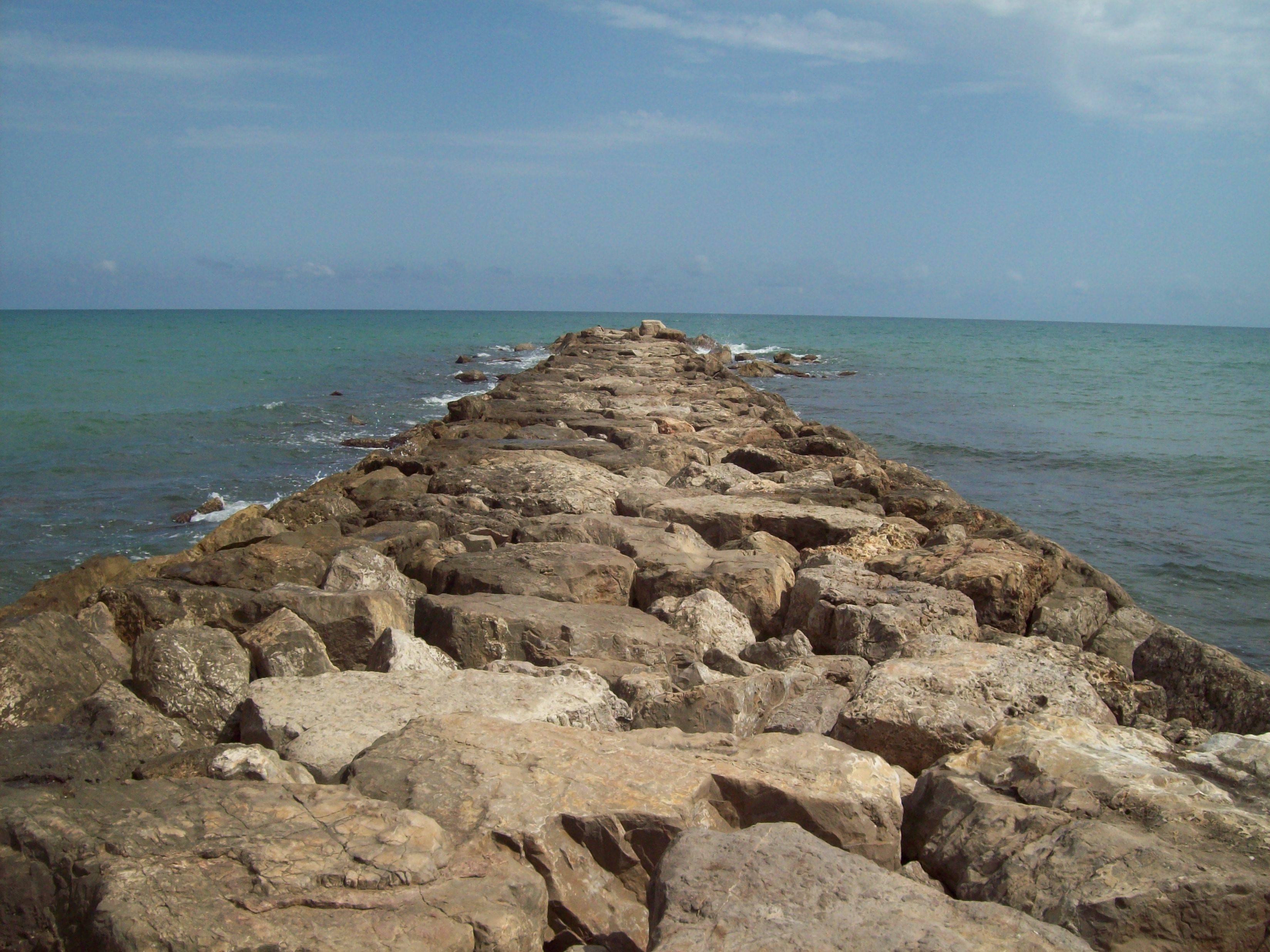
We made a lot of photos, we noticed the well-kept fortress and we tried to imagine how our ancestors were defending this building. Soroca is placed on the shore of river Nistru (on the other side beginsUkraine), so the landscape is fabulous! It’s a bit cold in the region of the fortress because of the water, but this sensation gives you a feeling of power and lordliness.

We had a nice, sweet walk, trying to find the road which takes us to the center of the city. During the stroll, we found a fountain and I asked him to take water out. After killing our thirst, we continued our way, straight to a big monument – Lumânarea Recunoștinței. In the city we saw some restaurants and shops-nothing special, just some places where you can pass the free time in a small city fromMoldova.

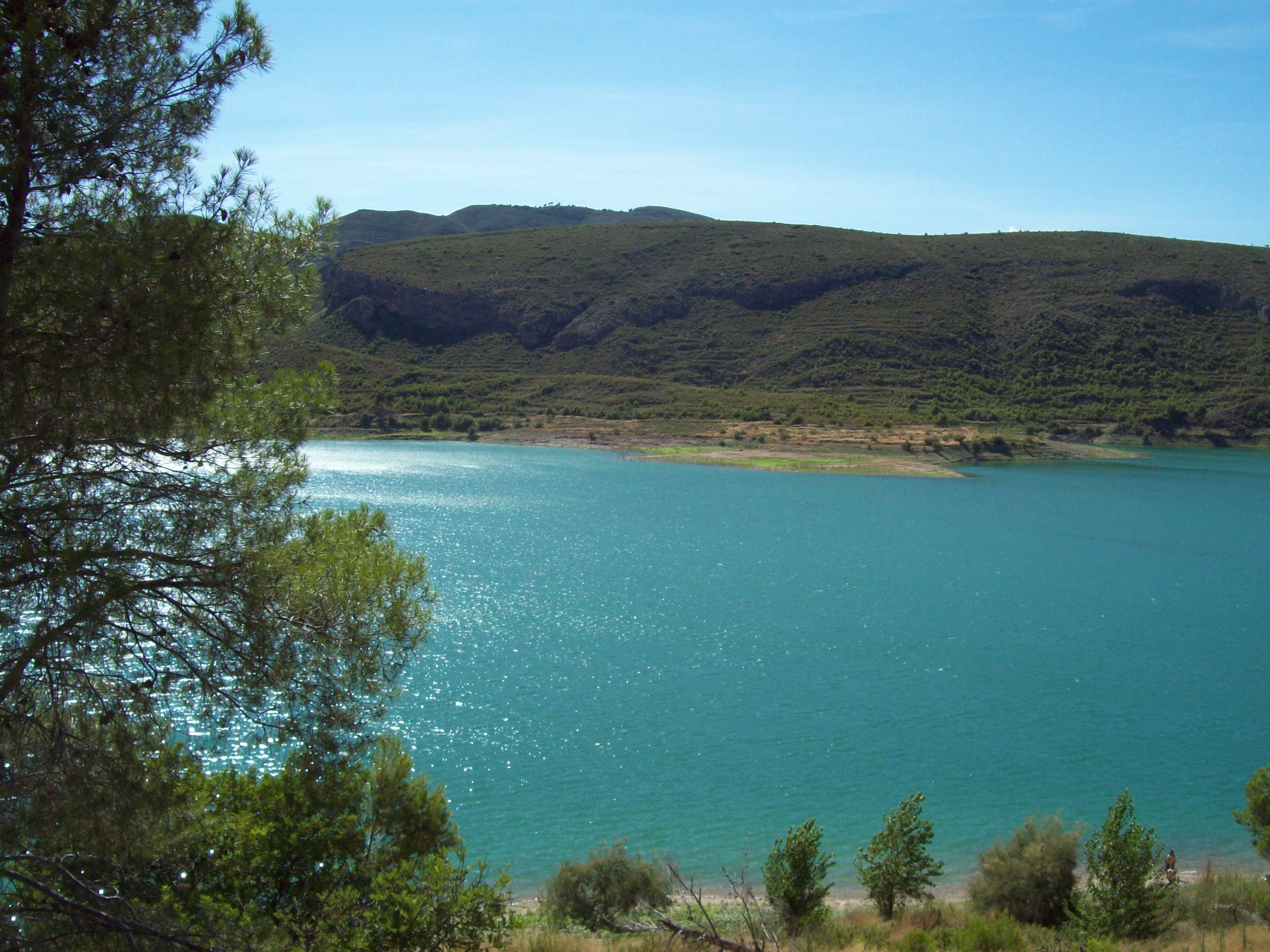
Well, if you want to see Lumânarea Recunoștinței’s monument, you may need a car, but if you don’t have it, you can do like us: walk almost 2 Km. We took the direction towards the entrance of the city, and we passed out Soroca. We had a short stoppage on the shore of Nistru, we saw some active fishes in the water, we talked, we made some photos and admired the beautiful landscape. We noticed also the border Moldova-Ukraine which was accessible only for the citizens of Ukraine and Moldova.

         The monument we are talking about is situated at 1 Km from Soroca, at a high of  656 stairs (i counted them!). While climbing the stairs, appears a fantastic view of the Nature: the beautiful forests with the multitude of green nuances of the trees, the road made by Nistru, the multi-millennial rocks. There,at the alttitude, you have the feeling that you’re untouchable, strong and free to do whatever you want. Here you can do an oath, near your love, even it doesn’t have a spiritual ancestral value..

In the interior of the monument, which looks like a candle, you will fiind a little „church” without altar where is possible to keep the marriage ceremony.

After we made some photos, we went back to the city, at the bus station and we took the bus at 6:00 PM (we bought the tickets earlier, when we arrived in the city-just to be sure we’ll have good seats). The driver took persons without tickes, but we weren’t disturbed by that.

 During the way back home (did you see this movie? J) we fell asleep, we talked, or we just were watching through the window and thinking at the day has just passed. In 2.5 hours we were in Chișinău, we stopped at a troleybus station, took the bus and came home tired and hungry.

We went together to bed thinking  the day was nice , the trip was interesting & exciting and we should fiind the next destination of our trip. However, wish we could do more to improve our sensation of good…

Această prezentare necesită JavaScript.

Miercurea Ciuc (România)


Miercurea Ciuc on the map

Miercurea-Ciuc (Hungarian: CsíkszeredaGerman:Szeklerburg) is the county seat of Harghita CountyRomania. It lies in the Székely Land, an ethno-cultural region in eastern Transylvania. The town is situated in the Olt River valley.

According to the Romanian census of 2002, there were 42,029 people living in the city. Of this population, 81.75% are ethnic Hungarians, primarily Székely, while 17.3% are ethnic Romanians, 0.62% are ethnic Romas and 0.33% declare other nationalities.

Roman Catholicism is the majority religion of Miercurea-Ciuc, its adherents numbering 74.06% of the total population. Romanian Orthodox (14.99%), Hungarian Reformed (7.41%), and Unitarian (2.05%) adherents represent the most significant other religious groups.

FOR TOURISTS

Petőfi Street is the main pedestrian street in the city. It has a young feel thanks to the presence of many students, and houses many restaurants and cafés. Their Székely specialities conjure up images of a small city in Western Europe.

The most obvious point of interest in Miercurea-Ciuc is the Baroque church at Csíksomlyó (see section below.) In the city centre, the main point of interest is the Mikó Castle, built in a late Renaissance style. The original more decorative castle was raised in the 17th century on the orders of Ferenc Mikó Hídvégi, the personal advisor of Gabriel Bethlen, then prince of Transylvania. Much of the castle was destroyed in 1661 during the Tatar raids, but it was rebuilt at the beginning of the 18th century and was mainly used as a barracks; today it houses the Csík Székely Museum. Behind the castle is a small Skanzen (museum village), consisting of a few traditional Csíki houses and wooden gates. Across the road from the castle is the city hall built in 1886, originally the county hall of the old Hungarian Csík County. Beside the castle is the 1904 Courthouse. The latest significant addition to the architectural landscape is the controversial 2001 Millennium Church, designed by Hungarian architect Imre Makovecz and located next to the Baroque Church of the Holy Cross.

Miercurea-Ciuc is twinned with:

Source: Wikipedia

Această prezentare necesită JavaScript.

Focșani (România)

Focşani (German: Fokschan; Hungarian: Foksány) is the capital city of Vrancea County in Romania on the shores the Milcov river, in the historical region of Moldavia. It has a population (as of 2002) of 101,854.

Focşani lies at a point of convergence for tectonic geologic faults, which raises the risk of earthquakes in the vicinity. It is one of the most popular wine-producing regions in Romania, Odobeşti being just to the northwest. Weisse von Fokshan is a famous local wine, and the vicinity is rich in minerals such as iron, copper, coal, and petroleum.

As a town on the MoldavianWallachian border, Focşani developed into an important trade center halfway between the Russian Empireand the Balkans. A congress between Imperial Russian and Ottoman diplomats took place near the city in 1772. Nearby the town, the Ottomans suffered a severe defeat at the hands of the allied forces of the Habsburg Monarchy under Prince Frederick Josias of Saxe-Coburg-Saalfeld and Imperial Russia under Alexander Suvorov in 1789 (see Battle of Focşani).

In the 1850s (after the Crimean War), Focşani grew in importance as the center of activities in favor of the union between Wallachia and Moldavia (the Danubian Principalities), leading to the double election of Alexander John Cuza in Iaşi and Bucharest. Following this, it housed a Central Commission regulating the common legislation of the two countries, as well as the High Court of Justice. Both institutions were disestablished in 1864, when the Romanian Principality was founded as a unified state. Focşani’s role in the forming of the modern Romanian state is immortalized in the Union Square Obelisk.

On 30-31 December 1881, following the impact of Zionism on the Romanian Jewish community, the First Congress of all Zionist Unions in Romania for the promotion of the colonization of Eretz Israel was held at Focşani. It was attended by 51 delegates, representing 32 organizations, two press editors, three newspaper reporters and important guests. This 1881 Congress, the first ever held, 16 years before the World Zionist Organization‘s First Zionist (held in Basel), had a major influence on the Romanian Jews, and its proceedings also became known outside the borders of Romania.

In 1917, during the Romanian Campaign of World War I, Focşani and Galaţi were part of a line of fortifications known as the Siret Line. An armistice was signed in the city on 9 December 1917, between the Kingdom of Romania and the Central Powers.

In 1944, during World War II, Focşani was supposed to be part of the fortified Focşani-Nămoloasa-Galaţi line, where 9 elite divisions were preparing to resist the Soviet Red Army‘s advance after the Battle of Târgul Frumos. However, due to the turn of events on 23 August 1944 (see Romania during World War II), this never materialized.

Focşani’s location on the Milcov river which divided Wallachia and Moldavia is depicted on its coat of arms, which represents the heraldic emblems of both principalities and a handshake.

Natives

Source: Wikipedia

Această prezentare necesită JavaScript.


Hărman (România)

Hărman (GermanHonigbergHungarianSzászhermány) is a former Saxon village in Braşov CountyRomania. It is located some 10 km east of Braşov, in the Burzenland region of southeastern Transylvania.

Source: Wikipedia

The Harman fortress is located 8 km north-east of Brasov. It dates back to the 13th century when the Saxons built the original church in a Romanesque style which was restored in a Gothic style.

Strong walls and bulwarks surrounded the church and on its sides there were massive towers. Conceived in the architectural style of the time, the church has a 50m high tower surrounded by four small towers. The local population added new parts to the original church in order to make it more useful to their needs. The chorus was built in square shape with a vault looking like a cross. It was surrounded by two chapels, as were Halmeag and Bartolomeu churches, indicating the influence of the Cistercian’s style.

The most significant event in the history of the fortification is the building in the 14th century of a massive tower on the West side for protective purposes. Though besieged 47 times during the history it never surrendered.

Source: Transylvaniatrips

Această prezentare necesită JavaScript.

Sfântu Gheorghe (România)


Map

Sfântu Gheorghe (Hungarian Sepsiszentgyörgy orSzentgyörgy, Yiddish: סנט דשזארדזש ) is a municipality and capital city of Covasna Countywhich also administers the villages of Chilieni (Kilyén) and Coşeni (Szotyor). Located in the central part of Romania and the historical region of Transylvania, it lies on the Olt River in a valley between the Baraolt and Bodoc Mountains.

Sights

  • Fortified Church (Romanian: Biserică Fortificată; Hungarian: Vártemplom) – constructed in the 14th century in the Gothic style
  • State Archive, the former headquarters of the Hussar battalions
  • County library constructed in 1832 as the seat of the county council
  • Theater used from 1854–1866 as the city hall
  • The market bazaar built in 1868, with a clock tower built in 1893
Population (2002)
– Total 61,543

Source: Wikipedia